Mapping No. 39
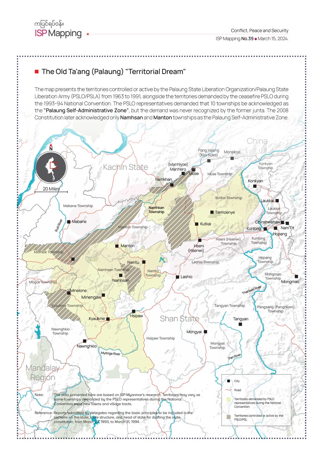
The Old Ta’ang (Palaung) “Territorial Dream”
The map presents the territories controlled or active by the Palaung State Liberation Organization/Palaung State Liberation Army (PSLO/PSLA) from 1963 to 1991, alongside the territories demanded by the ceasefire PSLO during the 1993-94 National Convention. The PSLO representatives demanded that 10 townships be acknowledged as the “Palaung Self-Administrative Zone”, but the demand was never recognized by the former junta. The 2008 Constitution later acknowledged only Namhsan and Manton townships as the Palaung Self-Administrative Zone.