Mapping No. 40
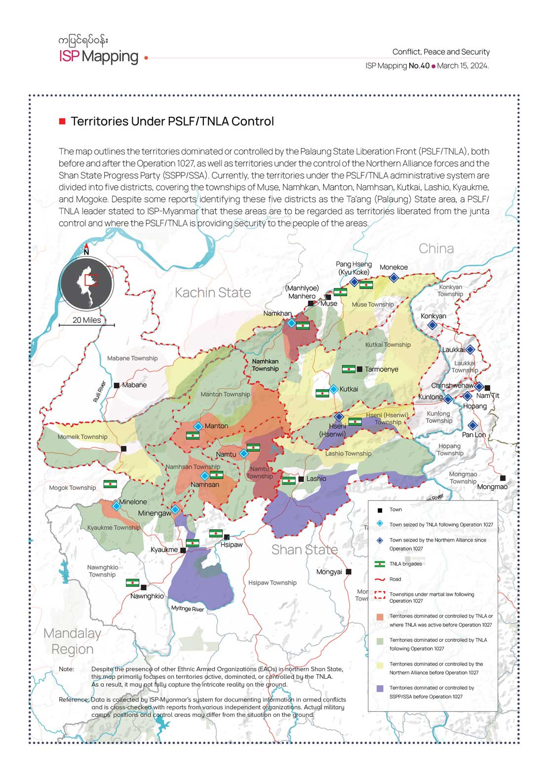
Territories Under PSLF/TNLA Control
The map outlines the territories dominated or controlled by the Palaung State Liberation Front (PSLF/TNLA), both before and after the Operation 1027, as well as territories under the control of the Northern Alliance forces and the Shan State Progress Party (SSPP/SSA). Currently, the territories under the PSLF/TNLA administrative system are divided into five districts, covering the townships of Muse, Namhkan, Manton, Namhsan, Kutkai, Lashio, Kyaukme, and Mogoke. Despite some reports identifying these five districts as the Ta’ang (Palaung) State area, a PSLF/TNLA leader stated to ISP-Myanmar that these areas are to be regarded as territories liberated from the junta control and where the PSLF/TNLA is providing security to the people of the areas.